Les Dents du Midi
The Dents du Midi are the seven toothy peaks of a mountain that dominates the Rhône Valley. Because of its commanding position Tanya and I have been looking hungrily at it for about as long as we've been in Switzerland; our first ski day here was at Portes du Soleil, which sits right under it. I remember being taken with the Dents, and I remember my surprise when a friend casually mentioned that it's not even a technical climb to walk to the highest point in summer. It's now autumn and the snow is starting to creep down the slopes, so Tanya and I decided that with the good weather last Sunday we would have a go at climbing it while we still could. We left early to hike the Haute Cime, which is the highest point at 3257 m.

The peak, seen from the train. The Haute Cime is the on the right.
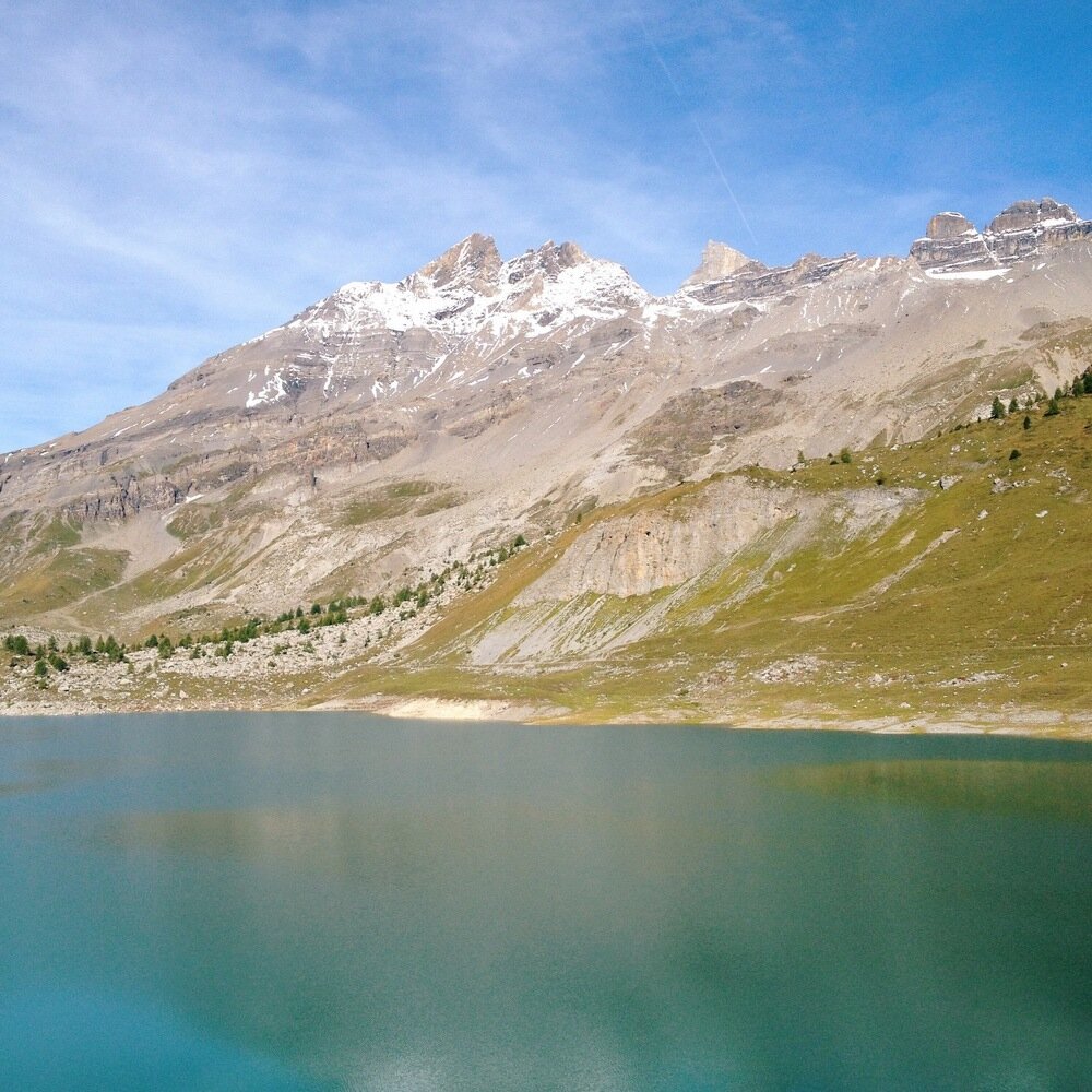
The walk is reasonably long and involves a lot of elevation. It was almost 20 km horizontally there and back, and an 1800 m climb from where we started, meaning it was a 2600-vertical-metre day. We started at Van d'en Haut and walked quickly up to the Lac de Salanfe, where we got the first good look at the south side of the Dents.
Haute Cime on the left, looking deceptively close.

Shadows and lake reflections.

The Tour Sallière (3220 m) over the Lac de Salanfe.
Next to the lake were Marmot-filled grasslands and a small braided river coming off the Tour Sallière. It was flat walking for a couple of kilometres before the track once again kicked uphill towards the Col de Susanfe.

Lovely painted track markers in these parts.
Tanya diligently following the track markers.
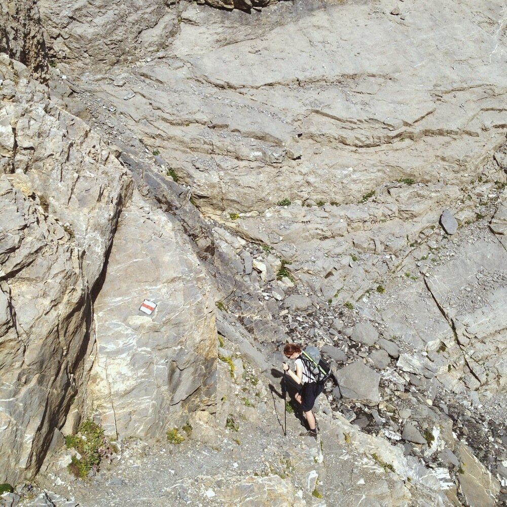
The Col de Susanfe is at 2494 m. By this height there are virtually no plants left around; the other day just a few pretty flowers dotted amongst the rocks and snow remained. It is from this col that the real steepness starts.


In nasty weather you can imagine you'd be pretty glad to see this little hut! Just below the Col de Susanfe.
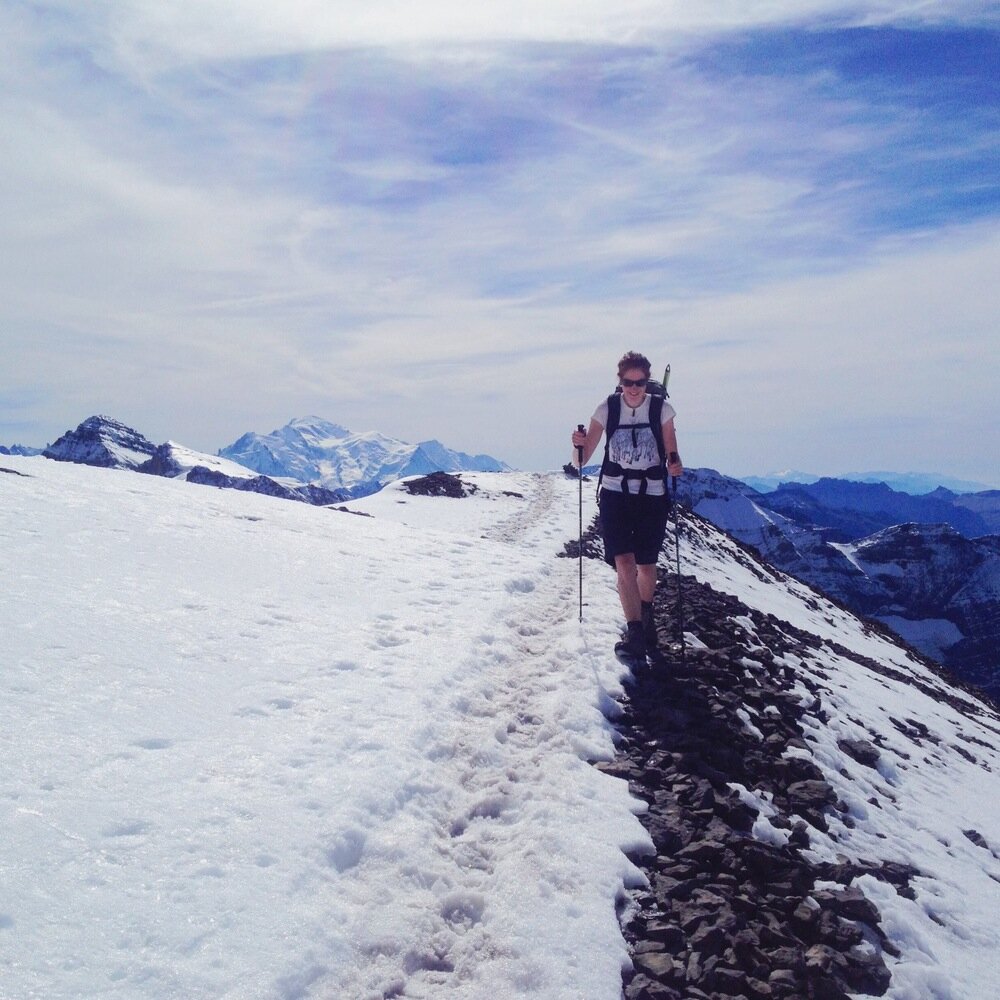
We pushed on, following the cairns, and the view started getting more and more incredible.


Pushing upwards. The Matterhorn is centre-right in the distance.
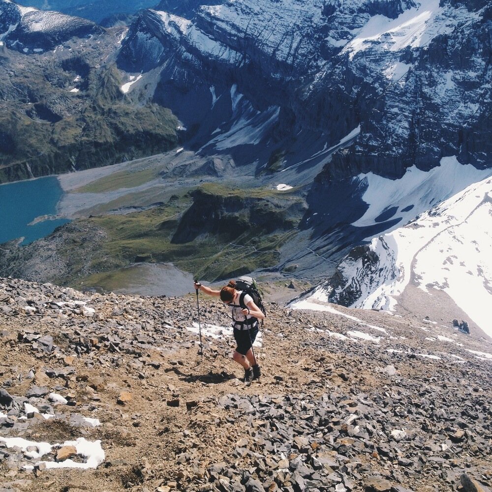
The next milestone after the Col de Susanfe is 500 m higher, and it's called the Col de Paresseux. Whoever named this point must have been in a harsh mood, because it means the "col of the lazy", as a swift kick to anyone who thinks that they've done well to break the 3000 m mark. I guess they had a point: it's only 200 m higher to get to the summit, up a steep scree and snow ramp.
At the Col de Paresseux, having crossed the 3000 m mark.

The other teeth: looking across the Doigts de Salanfe towards La Cathedrale, La Forteresse, and the Cime de l'Est.
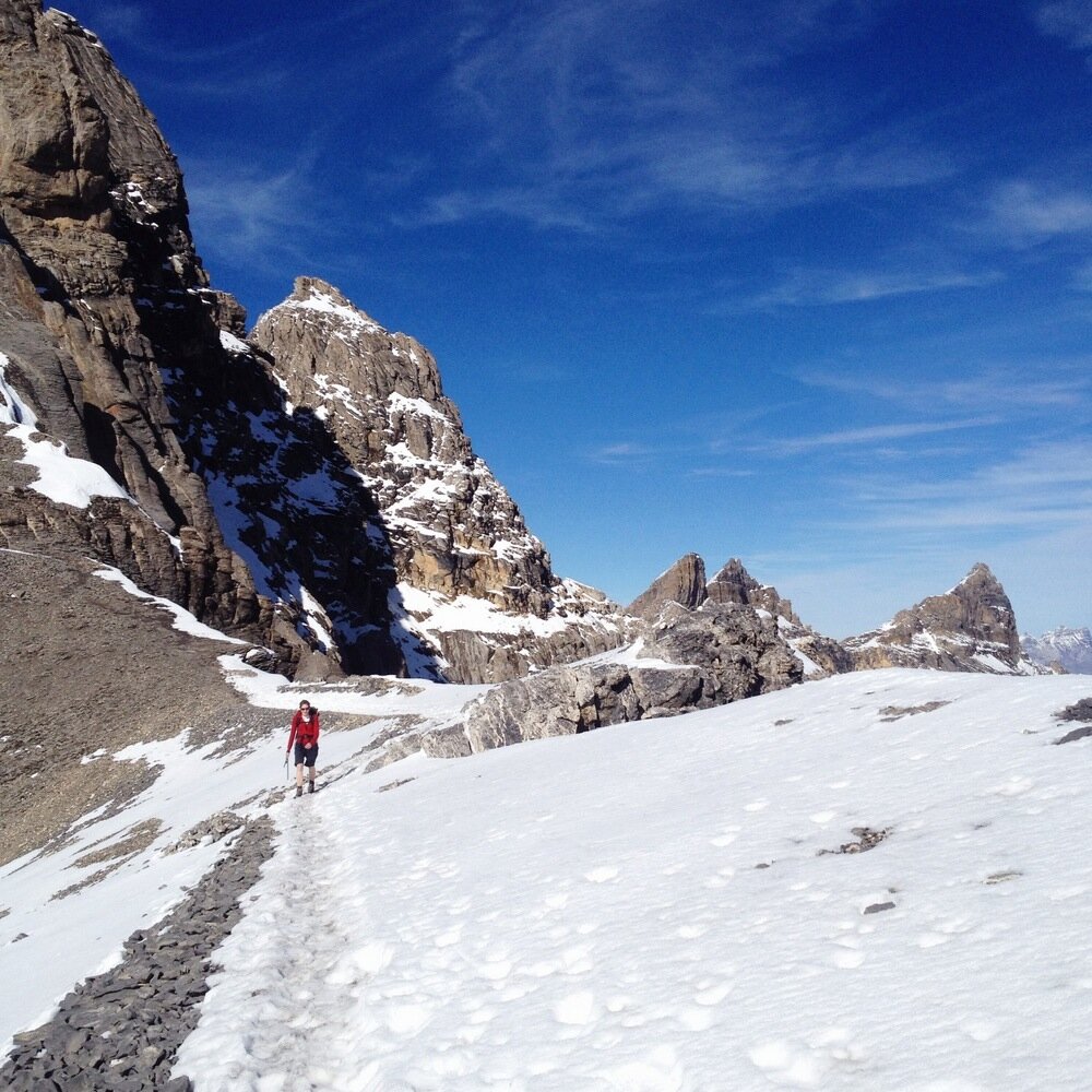
I do mean steep, though. I think the slope was approaching 40 degrees, and with the snow around it was reasonably slippery, and we had to move carefully. For the top fifty metres or so we were walking next to a giant void that somewhat sharpened the mind towards absolutely sure footing.


Reaching the summit was great for two reasons - firstly, we'd made it, and secondly, we got to peek our noses over the imposing north face and check out the view on the other side, which had been hiding from us all day so far. It was incredible! The north face drops away almost vertically, and just below lies Champéry which is part of Portes du Soleil. Further off was the Rhône Valley stretching back to Lac Léman. To our south we could see Mont Blanc, and scanning across there was the Grand Combin, The Matterhorn, Mont Fort, and further still, to the north-east, the Bernese Alps with the Eiger. The view would be worth twice the walk.

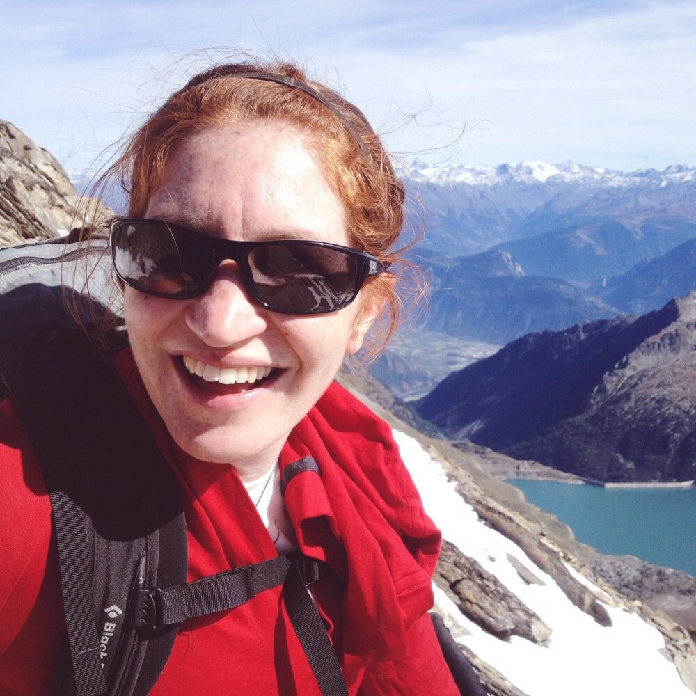
Tanya on the Haute Cime des Dents du Midi (3257 m).

The view south; Mont Blanc behind and the Tour Sallière in front.

Looking down the very steep north/west face of the Dents du Midi.

The summit cross.

The Rhône Valley with Lac Léman behind.
We didn't linger on the summit, and we soon started down again. The top slope demanded attention but was otherwise fine. The walk down was marked by the presence of two gently wandering bouquetin, a mother and calf, that we met just as we walked into the shadow of the Tour Sallière. They watched us but were not worried by two passers-by. They must be used to seeing people walking out in the afternoon, ecstatic after a great day in the mountains.


Looking back at the steepest section.

About to walk out of the sunlight and into the shadow of the day.